


Area Highlights
A quick view of the most influential metrics in Jersey City.
Living in Jersey City: neighborhoods, housing, schools, transit, parks and buyer guidance
A buyer-focused guide to Jersey City’s major neighborhood areas, waterfront and inland housing, public-school assignment, PATH and Hudson-Bergen Light Rail, ferries and buses, parks and daily amenities, zoning and redevelopment, historic review, parking, water and sewer conditions, association documents, permits, taxes and exact-address ownership decisions.
Jersey City is one municipality, but not one uniform housing, transit or daily-living market
The city extends from The Heights in the north to Greenville and the Bayonne border in the south, with Downtown on the Hudson River and West Side neighborhoods toward the Hackensack River. Neighborhood names are useful for orientation, but precise conditions depend on the address, building entrance, block, lot, elevation, station route and governing land-use documents.
The Heights: Central Avenue, Pershing Field and the Palisades edge
The Heights occupies the northern portion of Jersey City and includes Central Avenue, residential side streets, Pershing Field, Reservoir No. 3, Riverview-Fisk Park and several routes toward Hoboken and Union City.
Housing ranges from one- and two-family homes to rowhouses, condominium conversions and newer apartment buildings. Slope, stairs, retaining conditions, bus routes and the walk to the 9th Street–Congress Street light-rail station can change sharply by block.
Test: grade, winter access, parking, bus stop, Central Avenue route and any stair or elevator connection used in the daily trip.
Journal Square and India Square: transit hub, institutions and active redevelopment
Journal Square centers on the PATH and bus transportation complex, with nearby areas commonly described as India Square, Five Corners, parts of Marion and the transition toward McGinley Square.
Inventory includes older apartment houses, condominium conversions, multifamily properties, commercial-residential buildings and new towers. Construction sequencing, station entrances, redevelopment plans and street-level activity are address-specific.
Review: the complete station route, approved projects, loading activity, evening conditions and whether the property sits in a redevelopment-plan area.
Downtown and the waterfront: Newport, Exchange Place, Paulus Hook and historic districts
Downtown contains several distinct submarkets, including Newport, Exchange Place, Paulus Hook, Harborside, Historic Downtown, Hamilton Park, Harsimus Cove, Van Vorst Park, The Village and the Powerhouse area.
The housing mix spans waterfront towers, full-service condominiums, brownstones, rowhouses, lofts and smaller walk-ups. PATH access, ferry service, light rail, garage rights, flood exposure, historic review and future view corridors differ materially within Downtown.
Compare: building entrance to the actual PATH platform or ferry slip, not merely the neighborhood name or straight-line distance.
West Side, Marion and Lincoln Park: residential blocks with varied transit routes
The western side of the city includes established one- and two-family streets, apartment buildings, condominium conversions, the Lincoln Park area, the New Jersey City University vicinity and corridors leading toward Route 440 and the Hackensack River.
Some addresses rely on buses, the West Side Avenue light-rail branch, a transfer to PATH or driving. Parking, roadway projects, environmental history and future waterfront or commercial development require parcel-level review.
Test: weekday and weekend trips to PATH, light rail, shopping, school or childcare, plus the actual drive and parking routine.
McGinley Square and Bergen Hill: a central transition between Journal Square and the south
McGinley Square and Bergen Hill sit along important routes such as Bergen Avenue and Montgomery Street, with institutions, neighborhood retail, rowhouses, multifamily buildings and apartment properties.
Local labels overlap, and one block may feel connected to Journal Square while another functions more like Bergen-Lafayette or West Side. Building condition, legal use, transit choice and nearby redevelopment matter more than a broad label.
Observe: slope, bus service, institutional activity, commercial uses, construction and the full walk to the selected PATH or light-rail station.
Bergen-Lafayette and Communipaw: rowhouses, conversions, light rail and park access
Bergen-Lafayette and Communipaw include residential blocks, former industrial or commercial properties, adaptive reuse, newer development, Berry Lane Park and multiple Hudson-Bergen Light Rail stops.
Proximity to Liberty State Park can be useful, but access points, rail crossings, truck routes, flood conditions, environmental records and planned development should be tested from the exact property.
Verify: legal use, prior site history, rail or road noise, park route, sewer conditions and any redevelopment-plan controls.
Greenville: southern residential neighborhoods and several light-rail access points
Greenville covers a large southern portion of Jersey City, with one- and two-family homes, multifamily buildings, apartment properties, neighborhood commercial corridors and connections toward Bayonne.
The area is too large for a single commute or housing profile. Danforth Avenue, Martin Luther King Drive, Ocean Avenue, Kennedy Boulevard and individual side streets each create different transit, parking and daily-service patterns.
Map: the exact bus or light-rail trip, shopping route, school assignment, flood profile and nighttime block conditions.
Liberty State Park, Caven Point and Port Liberté: southeast waterfront conditions
The southeast includes Liberty State Park, Caven Point, marine and industrial edges, and the Port Liberté waterfront community. The setting is geographically distinct from Downtown even when Manhattan or harbor views are present.
Road access, ferry availability, light-rail connections, association services, flood and wind exposure, environmental records and distance to everyday retail should be evaluated independently.
Confirm: current park and ferry access, association transportation, flood insurance, garage elevation, evacuation route and future public work.
Map limitation: the diagram is a practical, north-up buyer-orientation map—not a survey, ward map, zoning map, redevelopment-plan map, historic-district map, school-zone map or legal statement of neighborhood boundaries. Smaller labels such as Hamilton Park, Harsimus Cove, Van Vorst Park, The Village, Newport, Paulus Hook, India Square, Marion, Communipaw, Bergen Hill, Country Village and others sit within or across the broader areas shown.
The same bedroom count can represent very different building, association, tax, parking, flood and maintenance obligations
Jersey City inventory ranges from full-service waterfront towers to brownstones, rowhouses, one- to four-family homes, loft conversions, smaller walk-up condominiums and new redevelopment projects. Buyers should compare the legal property, common elements, systems, finances and recorded rights—not only the interior finishes.
High-rise condominiums and full-service waterfront buildings
Elevator towers may include staffed lobbies, garages, amenity floors, central mechanical systems, backup power and complex insurance programs. Monthly charges are only one part of the ownership cost.
Review the master deed, budget, reserves, assessments, engineering, insurance, elevator history, facade obligations, garage rights, flood plan and any sponsor or developer control.
Do not assume: a newer tower has no capital exposure, protected views or universally included amenities.
Brownstones, brick rowhouses and attached townhomes
Historic and historically influenced homes can offer stoops, tall ceilings, masonry character, rear yards and multi-level layouts. Attached construction creates party-wall, roof, drainage and access questions.
Visible exterior work may require historic or zoning approval. Cellars, rear additions, decks, roof structures and converted floor plans should be compared with permits and approved plans.
Inspect: masonry, cornice, roof, party walls, cellar moisture, drainage, rear structures and historic status.
One- to four-family homes and legal occupancy
Many neighborhoods include one- to four-family properties with separate units, shared utilities, garages, yards and basement or attic areas. The marketed bedroom or unit count may not establish lawful occupancy.
Confirm zoning, tax records, certificates, approved plans, meters, fire separation, egress and the status of every kitchen, bathroom and sleeping area.
Legal-use file: title description, tax record, construction record, certificates, rent documents and current physical layout.
Walk-up condominiums and small associations
Smaller condominium associations can offer lower monthly charges and more direct decision-making, but a limited number of owners may share major roof, facade, sewer, masonry or insurance costs.
Informal management does not remove the need for budgets, reserves, minutes, insurance, tax filings, contracts and written responsibility for common elements.
Calculate: each unit’s percentage interest and likely share of known or foreseeable projects.
Lofts, conversions and adaptive-reuse buildings
Former commercial, warehouse, industrial or institutional buildings may provide larger rooms, high ceilings and distinctive construction. Conversion history can also create acoustic, envelope, utility, environmental and legal-use questions.
Review the original use, conversion approvals, environmental reports, floor assemblies, windows, roof, mechanical distribution and any remaining commercial uses.
Verify: certificate, remediation or closure documents, sound transfer, HVAC responsibility and window or facade obligations.
New construction and redevelopment projects
New condominium and townhouse projects require review of the public offering statement, sponsor history, estimated budget, warranties, completion obligations, tax treatment and construction documents.
Nearby redevelopment may continue after occupancy and can affect sidewalks, traffic, views, dust, noise, parking and retail delivery.
Separate: the condition of the new unit from the financial and operational condition of the new association.
Parking, storage, balconies, terraces and roof rights
A space may be deeded, assigned, licensed, leased or part of the common elements. The same distinction applies to storage cages, yards, balconies, terraces and roof areas.
Confirm dimensions, access, transfer rights, monthly charges, taxes, EV rules, flood exposure, maintenance responsibility and any right of reassignment.
Use documents: marketing language and a painted number are not substitutes for recorded and association rights.
Occupied, income-producing and rent-regulated property
A buyer of an occupied unit or multifamily property should review every lease, rider, registration, deposit, payment ledger, notice, petition and tenant communication.
Jersey City maintains landlord-registration and rent-control functions, but applicability, exemptions and lawful rent are unit-specific legal questions.
Coordinate: attorney, title, municipal record and property-management review before relying on projected income.
Documents that should exist before a condominium decision is complete
The appropriate file depends on the building and transaction, but a polished lobby or recent renovation does not replace governance, financial and engineering review.
- Master deed, bylaws, rules, amendments and unit percentage interest
- Current budget, recent financial statements and reserve information
- Board and owner meeting minutes for the available review period
- Adopted, pending and discussed special assessments
- Master insurance, flood coverage, deductibles, claims and renewal status
- Facade, roof, elevator, garage, plumbing and mechanical reports
- Litigation, violations, warranty claims and regulatory matters
- Parking, storage, terrace, balcony, yard and roof-use documents
- Leasing, pet, move, renovation, EV and amenity rules
- Flood, emergency, evacuation, backup-power and continuity plans
School decisions require the exact address, current district procedure and a separate review of assignment versus application-based options
Jersey City Public Schools publishes attendance-zone and registration information, while preschool, specialized programs, charter and private options can follow separate rules. Buyers should avoid treating a nearby campus, third-party rating or neighborhood label as an enrollment guarantee.
Attendance zones begin with the precise address
Jersey City Public Schools publishes attendance-zone information and directs families to confirm the assigned school for the exact address. A neighborhood name, ZIP code or nearby school is not sufficient.
Boundary files, programs, capacity and administrative procedures can change, so verification should be repeated when a move or enrollment decision is being made.
Save: the dated locator result and written district guidance used for the decision.
Pre-K registration and placement use their own process
District and contracted-provider preschool options follow current age, residency, registration, documentation, capacity and placement rules.
A nearby provider or prior-year arrangement does not guarantee placement for a specific child, address or school year.
Confirm: eligibility date, required documents, application window, provider assignment, hours and before- or after-care.
District pathways, programs and high-school choices require current review
JCPS operates schools and programs across the city. Grade configuration, admissions, lotteries, specialized offerings, transportation and high-school procedures are not uniform.
Use current district materials rather than third-party summaries when a program is central to the purchase decision.
Ask: what is assigned, what requires an application, what is capacity-limited and what transportation is provided.
Charter, private, parochial and county options are separate decisions
Jersey City families may also consider charter, private, parochial, magnet or county-based programs. Each has independent admissions, tuition, lottery, residency, calendar and transportation rules.
A real-estate purchase should not be conditioned on assumed admission without written confirmation from the relevant institution.
Compare: admission status, total cost, schedule, commute, after-care and re-enrollment terms.
Build the school and childcare route into the property analysis
A workable school plan includes the assigned or admitted program, registration status, schedule and complete transportation routine.
- Dated exact-address attendance-zone result
- Grade configuration and current enrollment procedure
- Pre-K eligibility, provider placement and before- or after-care
- Application, lottery or admissions status for non-assigned programs
- Walking route, crossing conditions and weather backup
- Bus, light-rail, PATH or driving time at arrival and dismissal
- School calendar, early-dismissal and holiday coverage
- Transportation, tuition and re-enrollment terms where applicable
School note: residency, registration or proximity does not guarantee a particular seat, preschool provider, specialized program, charter admission or private-school acceptance. Confirm all material placement questions directly with the responsible school or district.
PATH is central to many searches, but Jersey City’s real transit network is station-, branch-, destination- and schedule-specific
Jersey City combines PATH, Hudson-Bergen Light Rail, buses, ferries, walking, cycling and regional roads. The correct comparison is the complete trip from the exact entrance, including transfers, accessibility, late-night service and a backup route.
PATH: four Jersey City stations with different routes and entrances
Journal Square, Grove Street, Exchange Place and Newport are the four PATH stations in Jersey City. Their service patterns, transfers, entrances, accessibility features and late-night or weekend operations differ.
The best station is the one that serves the rider’s actual destination and schedule from the specific building entrance.
Run: the complete door-to-platform and destination-platform-to-office trip during the intended travel periods.
Hudson-Bergen Light Rail: waterfront and western/southern connections
The light-rail network links Jersey City neighborhoods with Exchange Place, Newport, Hoboken, Bayonne and other Hudson County destinations. Some trips require a transfer to PATH, ferry, bus or walking route.
Station access, grade crossings, schedule frequency and construction impacts should be checked live.
Test: walking approach, platform access, transfer time, service after the expected return hour and weather exposure.
Ferries: useful for selected waterfront addresses and destinations
Ferry terminals and routes can serve parts of the waterfront, including Paulus Hook, the Liberty Harbor area and Port Liberté when service is operating.
Ferry usefulness depends on the current route, destination, fare, operating window, backup plan and the walk from the property.
Verify live: terminal, timetable, weekend service, weather procedures and cross-honoring before relying on a ferry commute.
Bus service: neighborhood reach without a single citywide pattern
NJ TRANSIT and other authorized bus services connect different parts of Jersey City with PATH, Hudson County, Newark, New York and local destinations.
Routes, stops, travel times and crowding vary by corridor. A bus shown nearby may run in the wrong direction or on a limited schedule for the intended trip.
Check: exact stop side, transfer, late return, weekend schedule and alternate route.
Driving: tunnels, turnpike access and neighborhood bottlenecks
The Holland Tunnel, New Jersey Turnpike extension, Routes 1&9, Route 139, Route 440 and local arterials create multiple regional options, but traffic conditions can differ sharply by hour and direction.
Garage exit time, one-way streets, school traffic, bridge or tunnel queues and construction should be included in the test.
Drive: the actual route at the relevant weekday and weekend times, including the return and parking maneuver.
Walking and cycling: block conditions matter more than a citywide label
Sidewalk width, crossings, slope, lighting, bike facilities, construction, rail crossings and winter maintenance vary across Jersey City.
A short map distance can include a steep grade, highway crossing, station mezzanine, waterfront detour or industrial road.
Walk twice: daytime and after dark, with the same bags, stroller, bicycle or mobility needs used in daily life.
Accessibility: confirm the complete accessible route
A station or building may be described as accessible while the preferred entrance, elevator, sidewalk route or transfer is temporarily unavailable or materially less convenient.
Check station alerts, elevator status, platform route, building access, curb conditions and backup transportation.
Document: the current accessible path and an alternate path before making the location dependent on one elevator or entrance.
Service changes: late nights, weekends and construction
PATH, light rail, ferry, bus and roadway operations can change for maintenance, events, emergencies and construction.
A weekday peak test alone does not show the trip after a late dinner, weekend event or service suspension.
Decision rule: identify at least one practical backup route and its real cost before selecting a location.
Test the trip under the conditions that will actually occur
Repeat the route rather than relying on a routing-app estimate captured once.
- 01
Building exitElevator, stairs, garage, bike room, package or stroller logistics and lobby-to-sidewalk time.
- 02
Street routeCrossings, grade, lighting, weather exposure, construction, traffic and station entrance.
- 03
Platform and transferFare, elevator or escalator, crowding, branch, transfer and service alerts.
- 04
Destination walkExit used, final blocks, security procedures and arrival-time requirement.
- 05
Late returnReduced service, ferry closure, missed connection, rideshare and garage access.
- 06
Backup routeReal travel time, cost and feasibility when the preferred service is unavailable.
Jersey City has several commercial centers rather than one universal downtown routine
Newark Avenue, Central Avenue, Journal Square and India Square, Bergen Avenue, West Side Avenue, the Route 440 area and the waterfront each support different combinations of dining, shopping, services, offices and transit. Business tenants and hours change, so buyers should map durable routines instead of depending on one current storefront.
Newark Avenue, Grove Street and Historic Downtown
This area concentrates restaurants, bars, neighborhood services, cultural uses, pedestrian activity and access to the Grove Street PATH station.
Convenience can come with deliveries, sanitation, events, outdoor dining, nightlife and construction. Floor level and window orientation affect the experience.
Visit: morning deliveries, dinner, late evening and weekend periods.
Central Avenue and The Heights
Central Avenue functions as a major neighborhood shopping and service corridor for The Heights, with nearby residential streets and connections toward Pershing Field and surrounding communities.
The practical relationship depends on slope, parking, bus route, distance from the commercial frontage and the location of the building entrance.
Map: grocery, pharmacy, coffee, childcare, gym and the return trip with packages.
Journal Square, India Square and Five Corners
The Journal Square area combines transit, offices, institutions, restaurants, specialty retail and residential development. India Square adds a distinct concentration of dining and shopping.
Construction, bus circulation, loading, pedestrian volume and station activity can vary within a few blocks.
Test: the route during peak transit, evening dining and active construction.
Bergen Avenue, McGinley Square and Jackson Hill corridors
Central and south-central corridors provide neighborhood retail, services, institutions and bus connections across several commonly used neighborhood labels.
Business mix and operating hours change over time, so a purchase should not depend on a specific tenant remaining in place.
Verify: present-day essentials and a backup for each service that matters.
West Side Avenue, the NJCU area and Route 440 access
The west side includes neighborhood retail, larger-format commercial areas, university activity and routes toward the light rail, Lincoln Park and the Hackensack River edge.
Walking conditions, road crossings and parking differ from Downtown, even when the same service is a similar map distance away.
Compare: walking, driving, delivery and transit access for the actual weekly routine.
Newport, Exchange Place, Harborside and the waterfront office district
Waterfront districts combine residential towers, offices, transit, retail and public-space connections. Weekday and weekend activity can feel different.
Retail turnover, office occupancy, construction, wind, ferry operations and garage access may influence daily use.
Observe: weekday lunch, evening, weekend and weather conditions.
Map a normal Tuesday, not only a weekend tour
A location can photograph well and still create friction in the daily schedule. Test the repeated trips that determine whether the address works.
- Primary and backup grocery
- Pharmacy and urgent care
- School or childcare route
- Gym, studio or recreation
- Dog walk and veterinary access
- Dry cleaning, packages and returns
- Restaurant and evening route
- Visitors and rideshare pickup
- Contractor and delivery access
- Weekend parking and events
- Rain and snow routine
- Late-night food and transportation
Open space is distributed across city, county and state systems with different entrances, facilities and rules
Liberty State Park, Lincoln Park, Berry Lane Park, Pershing Field, Reservoir No. 3, Riverview-Fisk Park, Hamilton Park, Van Vorst Park and waterfront spaces serve different purposes. The practical value depends on the exact route, entrance, facility, program and current access—not only the acreage shown on a map.
Liberty State Park: a state-managed waterfront resource
Liberty State Park provides major waterfront open space, views, paths, historic and transportation-related sites, and access points from different parts of Jersey City.
It is managed by the State of New Jersey, and access, construction, programming and parking conditions can change.
Confirm: the current entrance, route, operating notices and planned work from the exact property.
Lincoln Park: a Hudson County park on the west side
Lincoln Park is a large county-managed park with active and passive recreation areas. Its relationship to a home depends on the specific entrance, roadway crossing and side of the park used.
County rules, field schedules, projects and facility access should be checked directly.
Walk: the preferred entrance and evening return rather than relying on the park boundary shown on a map.
Berry Lane Park and Bergen-Lafayette recreation
Berry Lane Park is a major city park serving Bergen-Lafayette and nearby areas, with recreation spaces and connections to surrounding streets and light rail.
Program schedules, field permits, maintenance work and event conditions vary.
Check: the actual pedestrian route, rail crossing, field schedule and event calendar.
Pershing Field, Reservoir No. 3 and Heights open space
The Heights includes Pershing Field, Reservoir No. 3, Riverview-Fisk Park and smaller parks or playgrounds. Facilities and access are not identical, and some routes involve slope or stairs.
Current hours, program registration and facility status should be verified.
Compare: active recreation, passive open space, dog route and seasonal access.
Hamilton Park, Van Vorst Park and the Downtown waterfront
Downtown offers neighborhood parks, playgrounds and segments of the Hudson River Waterfront Walkway. The closest green space may have a very different function from a larger destination park.
Construction, events and maintenance can temporarily change access or noise.
Identify: the everyday park, the weekend park and the route to each.
Recreation programs, pools, fields and permits
City recreation offerings include sports, aquatics and enrichment programs, with registration, residency, capacity, fees and facility rules that can change by season.
A nearby facility does not guarantee admission to a specific class, team, field time or pool session.
Use live sources: confirm registration dates and availability when a program is important.
A Jersey City parcel may sit inside several overlapping land-use and regulatory layers
Base zoning, redevelopment plans, historic districts, overlays, variances, easements, construction records and environmental history can affect current use, renovation, expansion and neighboring development. Broad neighborhood research should be followed by a block-and-lot file.
Base zoning is only the first planning layer
A parcel may be governed by the Land Development Ordinance, a redevelopment plan, an overlay, a historic district or a combination of controls.
The label shown on a general real-estate website is not a zoning determination.
Start: block and lot, current interactive map, governing plan text and written zoning confirmation when needed.
Redevelopment plans can control use, height, design and process
Jersey City has numerous redevelopment-plan areas. A plan may replace or supplement ordinary zoning rules and can shape adjacent construction as well as the subject property.
Plan boundaries and amendments should be reviewed as of the contract period.
Read: the actual adopted plan and amendments—not only the map legend or a broker summary.
Historic districts and landmarks affect exterior work
Local historic status can require review for windows, doors, masonry, stoops, cornices, additions, roof structures and other visible work.
A building’s age or appearance alone does not establish whether it is regulated.
Confirm by address: district or landmark status, prior approvals, violations and the proposed scope.
Permits, certificates and approved plans establish legal work
Renovated kitchens, added bathrooms, finished basements, roof decks, additional units and changed layouts should be matched to permits, inspections, certificates and approved plans.
Tax records and listing descriptions do not replace construction-code records.
Compare: current physical conditions with the entire permit history and any open violations.
Future construction can affect views, light, traffic and access
Vacant lots, parking lots, low-rise buildings and redevelopment sites may support future construction. Current skyline or water views are not automatically protected.
Approved projects are only part of the analysis; underlying development rights also matter.
Map: nearby lots, ownership, zoning, adopted plans, approvals, applications and construction staging.
Environmental and prior-use review is property-specific
Former industrial, commercial, rail, fill or waterfront properties can require environmental, vapor, soil, tank or groundwater review. Residential conversion does not itself prove that every concern is closed.
The appropriate scope depends on property history, lender, use, reports and professional advice.
Request: environmental reports, remedial documents, no-further-action or response-action records, tank records and engineering review where relevant.
Questions to resolve before relying on present conditions or future potential
The correct file is assembled from current municipal records and qualified professional review.
- Exact block, lot, qualifier and recorded property description
- Base zoning, overlay and adopted redevelopment plan
- Historic district or landmark status
- Variances, planning approvals, resolutions and conditions
- Construction permits, inspections, certificates and open violations
- Approved plans compared with the current layout
- Adjacent-lot zoning, ownership, approvals and applications
- View, light, access, party-wall and easement rights
- Infrastructure, street, water, sewer and transit projects
- Environmental history, tanks, remediation and professional reports
Use the responsible agency for current rules, records, schedules and address-specific status
Parking, sanitation, permits, taxes, water, sewer, libraries, landlord registration and rent-control administration are handled through different offices. Service details change, and a seller or building manager may not have the current answer.
Parking and street operations
Permit zones, street cleaning, meters, temporary restrictions, curb rules and municipal lots vary by location. Posted signs and current Division of Parking rules control.
Public Works and sanitation
Collection schedules, recycling, bulk items, snow operations and street work are time-sensitive. Confirm building setout rules and responsibility.
Water, sewer and lead-service information
JCMUA provides water and sewer resources, project information, service-line lookup and lead-replacement information. Building plumbing remains a separate inspection issue.
Libraries and learning resources
Jersey City Free Public Library operates a main library, branches and learning locations. Current hours, closures and programs should be checked live.
Resident Response Center
The Resident Response Center is the City’s central point for information or assistance with municipal services and resident concerns.
Online permitting and licensing
Planning, zoning, construction and other applications use the City’s current online permitting and licensing portal. Record access and application status are process-specific.
Tax Assessor and Tax Collector
Assessment, billing, deductions, appeals and payment questions are handled through separate municipal offices. Verify current assessment, taxes and any abatement or PILOT documents.
Landlord, tenant and rent-control records
Housing Preservation and Landlord/Tenant Relations administer registrations and the City’s rent-control framework. Applicability and lawful rent are unit-specific.
City Clerk, OPRA and municipal records
The City Clerk provides the official OPRA portal, municipal codes, public-meeting records and other municipal documents.
Build one decision file that connects the unit, building, parcel, block, neighborhood and commute
Jersey City transactions often involve several overlapping questions: legal use, association finances, permits, parking rights, taxes or PILOTs, flood and sewer conditions, historic or redevelopment controls, occupied-property records and nearby construction. Each should be resolved at the correct level.
Twelve files that commonly change the ownership decision
Scope the review to the property type and rely on attorneys, inspectors, engineers, insurance professionals, lenders and municipal agencies for their respective subjects.
- 01
Legal use and titleConfirm the deed, tax lot, unit or property description, lawful unit count, easements, party-wall rights and any restrictions.
- 02
Permits and certificatesMatch every renovation, addition, roof deck, basement, bathroom, kitchen and changed occupancy to approved records.
- 03
Association or shared-building fileReview governance, finances, reserves, assessments, insurance, engineering, litigation, contracts and owner obligations.
- 04
Taxes, assessment and PILOTVerify current bills, assessment, payment status, abatements, PILOT agreements, appeals and post-closing treatment.
- 05
Flood, drainage and sewerReview mapping, elevation, prior water entry, sewer backup, pumps, valves, claims, insurance and emergency procedures.
- 06
Parking and accessConfirm legal rights, dimensions, clearances, curb or garage access, monthly costs, EV rules, flooding and reassignment provisions.
- 07
Envelope and structureInspect roof, facade, windows, balconies, masonry, foundation, retaining walls, terraces and water-management details.
- 08
Mechanical, elevator and life safetyReview HVAC, electrical, plumbing, fire systems, elevator records, backup power and major replacement planning.
- 09
Water service and interior plumbingCheck service-line material or replacement status separately from risers, branches, fixtures and water pressure.
- 10
Leases and rent regulationFor occupied property, verify leases, registrations, deposits, lawful rent, exemptions, notices and pending proceedings.
- 11
Noise, operations and constructionTest traffic, rail, ferry, aircraft, nightlife, school, sanitation, deliveries, construction and building mechanical noise.
- 12
Adjacent development and viewReview zoning, redevelopment plans, approvals, applications, vacant sites, construction staging and protected rights.
Flood and sewer note: Jersey City’s combined-sewer and waterfront conditions do not affect every property in the same way. A high-floor unit can remain exposed through common systems, insurance, garage, elevator, access or assessment risk. Use exact-property mapping, history, engineering and insurance review.
Primary links for neighborhood, zoning, school, transit, utility, tax and municipal verification
These links provide starting points. Save dated records and written confirmations used for a material purchase decision because maps, schedules, rules, fees, boundaries and agency procedures can change.
Use the same transit, housing, parking and ownership test across Hudson County and the Gold Coast
Compare the right neighborhood, building and ownership structure before narrowing the listing search
New Jersey Proper can organize the search around the buyer’s actual PATH or light-rail route, housing type, school or childcare plan, parking needs, building-service preferences, outdoor space, flood and association criteria, and property-level due diligence.
Direct answers to common Jersey City questions
Open each question for a concise, neutral answer. Material property, school, tax, transit and legal questions should still be confirmed through current official records and qualified professionals.
What are the main areas of Jersey City?
Are Jersey City neighborhood boundaries legally fixed?
Is the neighborhood map in this guide an official boundary map?
What areas are generally considered Downtown Jersey City?
What is The Heights?
What is Journal Square?
What is Bergen-Lafayette?
What is West Side?
What is Greenville?
How many PATH stations are in Jersey City?
Which PATH station is best?
Does the Hudson-Bergen Light Rail serve Jersey City?
Does Jersey City have ferry service?
Can a buyer rely on a fixed commute time to Manhattan?
Do residents need a car?
How does residential parking work?
Is a condo parking space always deeded?
How is a public school assigned?
Does buying near a school guarantee enrollment there?
Does Jersey City have public Pre-K?
What other school options exist?
What housing types are common in Jersey City?
What should a condo buyer review?
What is a special assessment?
Can a high-floor unit still have flood exposure?
Is every Jersey City property in a flood zone?
Does Jersey City have a combined sewer system?
What sewer questions should a buyer ask?
Why should a buyer check the water service line?
Does Jersey City have historic districts?
Can an owner freely replace windows or alter a facade in a historic district?
What is a redevelopment plan?
Can future construction affect a view?
How should buyers verify renovated space?
How can a buyer confirm a legal multifamily use?
Does Jersey City have rent control?
What records are needed for an occupied property?
How should buyers evaluate property taxes?
What is a PILOT or tax abatement?
Who manages Liberty State Park?
Who manages Lincoln Park?
Does Jersey City have public libraries throughout the city?
How should buyers evaluate noise?
When is environmental review important?
What is the most important Jersey City location test?
Which nearby markets should Jersey City buyers compare?
Where can buyers find current Jersey City homes for sale?
All neighborhood, ward, zoning, redevelopment, historic, school, transportation, parking, ferry, business, recreation, park, utility, flood, sewer, property-record, tax, PILOT, landlord-registration, rent-regulation and closing information is subject to change. The schematic map is for rough orientation only and does not establish legal boundaries or property rights. School residency and registration do not guarantee a specific placement or program. Public infrastructure and resiliency work can reduce risk but do not guarantee that a property will not flood or experience sewer, drainage, access or service problems. Buyers should independently verify all material unit and building facts, legal use, association documents, permits, plans, certificates, historic and redevelopment status, parking and outdoor-space rights, water and sewer systems, service-line material, flood and drainage conditions, insurance, taxes, PILOT agreements, title rights, leases, rent-control status, environmental history and future-work feasibility with the responsible agencies and qualified professionals.
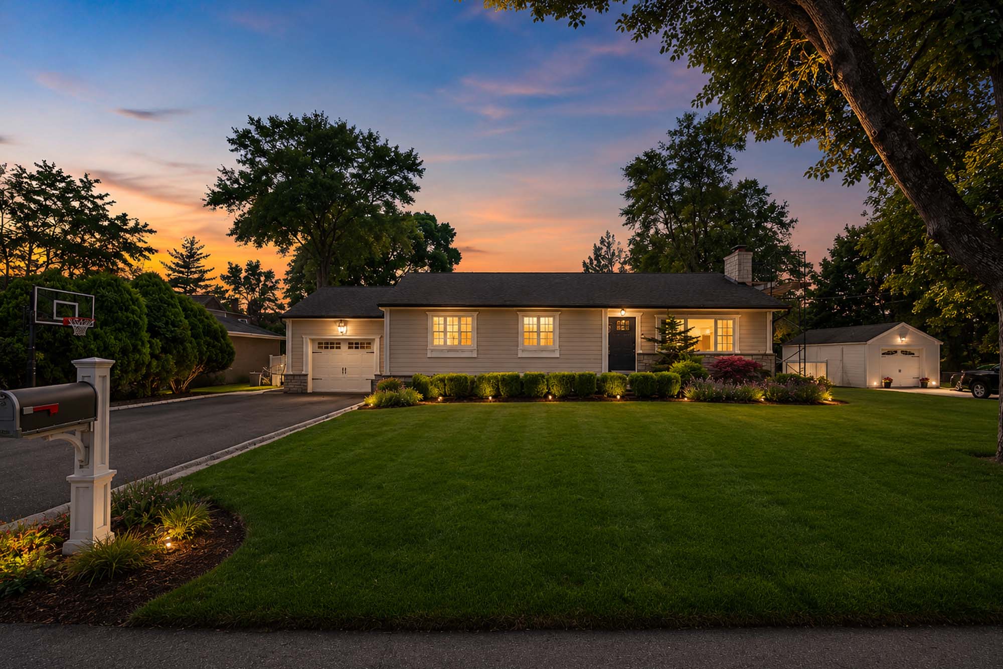
Daily Voice Features NJ Proper’s $910,000 …
MIDLAND PARK, NJ — A renovated two-bedroom ranch has become a headline-making sale in Bergen County.…

Five Highest-Priced NJMLS Residential Sale…
The $9.25 million closing of 23 E Denison Drive is the highest-priced qualifying NJMLS residential s…

The Northern New Jersey Luxury Price Ladde…
A million-dollar budget can produce very different results across Northern New Jersey. Here is how l…