


Area Highlights
A quick view of the most influential metrics in Westwood.
Westwood, NJ Housing Market (NJMLS) — 10-Year Snapshot (2016–2025)
Source: NJMLS Statistics Report • Town: Westwood (0267) • County: All Counties • Property type: All • Full-year periods (Jan 1–Dec 31)
2025 at a glance
- Closed sales: 81
- Median sale price: $726,250
- Average sale price: $704,192
- Sale-to-original list price: 103.31%
- Average days on market: 30
- Year-end inventory: 3.56 months (24 current actives)
- Success ratio: 71.1% (81 sold, 16 withdrawn, 17 expired)
2025 vs 2024
- Median sale price: $726,250 vs $675,000 (+7.6%)
- Average sale price: $704,192 vs $701,785 (+0.3%)
- Sale-to-original list price: 103.31% vs 103.77% (-0.46 pts)
- Average DOM: 30 vs 33 (-3 days)
- Closed sales: 81 vs 93 (-12)
- Success ratio: 71.1% vs 66.0% (+5.1 pts)
- Months inventory: 3.56 vs 3.10 (+0.46)
10-year trend (2016 → 2025)
- Median sale price: $447,000 → $726,250 (+62.5%)
- Average sale price: $450,733 → $704,192 (+56.2%)
- Average DOM: 60 → 30 (-30 days)
- Sale-to-original list price: 96.45% → 103.31% (+6.86 pts)
- Highest success ratio: 72.1% (2020)
- Inventory range (year-end): 2.12–3.56 months
| Year | Sold | New | Median Sold | Average Sold | Sale/OLP | Avg DOM | Withdrawn | Expired | Success Ratio | Current Actives | Months Inv. |
|---|---|---|---|---|---|---|---|---|---|---|---|
| 2016 | 101 | 284 | $447,000 | $450,733 | 96.45% | 60 | 44 | 67 | 47.7% | 24 | 2.85 |
| 2017 | 127 | 247 | $429,000 | $428,976 | 96.65% | 50 | 29 | 52 | 61.4% | 24 | 2.27 |
| 2018 | 116 | 287 | $462,500 | $454,032 | 97.99% | 43 | 48 | 37 | 57.1% | 24 | 2.48 |
| 2019 | 116 | 261 | $470,000 | $475,891 | 96.83% | 43 | 54 | 41 | 55.2% | 24 | 2.48 |
| 2020 | 132 | 260 | $500,000 | $505,426 | 99.69% | 34 | 20 | 31 | 72.1% | 24 | 2.18 |
| 2021 | 136 | 249 | $510,000 | $530,731 | 101.29% | 29 | 26 | 35 | 69.4% | 24 | 2.12 |
| 2022 | 119 | 237 | $588,000 | $659,215 | 101.30% | 36 | 24 | 27 | 69.2% | 24 | 2.42 |
| 2023 | 90 | 215 | $585,500 | $658,383 | 102.26% | 35 | 20 | 33 | 62.5% | 24 | 3.20 |
| 2024 | 93 | 201 | $675,000 | $701,785 | 103.77% | 33 | 15 | 33 | 66.0% | 24 | 3.10 |
| 2025 | 81 | 182 | $726,250 | $704,192 | 103.31% | 30 | 16 | 17 | 71.1% | 24 | 3.56 |
Success ratio = Sold ÷ (Sold + Withdrawn + Expired). Months inventory and current actives reflect the year-end snapshot shown in the NJMLS report.
Top 10 Most Expensive Single-Family Home Sales in Westwood, NJ (2000–2025)
Closed residential single-family sales in Westwood from 01/01/2000 through 12/31/2025,
ranked by sold price. Fields shown include address, MLS-recorded style, beds/baths, days on market, sold date, sold price,
and buyer origin (city/state). Public display excludes MLS identifiers.
| Rank | Address | Style | BR | FB | HB | DOM | Sold Date | Sold Price | Buyer City | Buyer State |
|---|---|---|---|---|---|---|---|---|---|---|
| 1 | 75 Bergen Street | Colonial | 5 | 4 | 1 | 17 | $1,548,000 | Westwood | New Jersey | |
| 2 | 79 Bergen Street | Colonial | 5 | 4 | 1 | 137 | $1,325,000 | Jersey City, NJ | New Jersey | |
| 3 | 75 Bergen Street | Colonial | 5 | 4 | 1 | 83 | $1,325,000 | Manhattan, NY | New York | |
| 4 | 29 Garden Place | Colonial | 5 | 5 | 0 | 64 | $1,299,000 | Belleville, NJ | New Jersey | |
| 5 | 8 Bryant Place | Colonial | 6 | 5 | 1 | 12 | $1,275,000 | Closter, NJ | New Jersey | |
| 6 | 131 Langner Place | Colonial | 4 | 3 | 2 | 6 | $1,230,000 | Hackensack, NJ | New Jersey | |
| 7 | 81 2nd Avenue | Colonial | 6 | 4 | 1 | 28 | $1,212,500 | Teaneck, NJ | New Jersey | |
| 8 | 81 2nd Avenue | Colonial | 6 | 4 | 1 | 24 | $1,200,000 | Englewood, NJ | New Jersey | |
| 9 | 35 2nd Avenue | Colonial | 4 | 3 | 1 | 20 | $1,200,000 | New York, NY | New York | |
| 10 | 128 Goodwin Terrace | Colonial | 7 | 3 | 3 | 31 | $1,200,000 | Westwood, NJ | New Jersey |
Source: closed residential single-family sales from 01/01/2000–12/31/2025. Public display excludes MLS identifiers.
“Style” reflects the MLS-recorded property style; buyer origin reflects the buyer mailing city/state as recorded and may not represent current residence.
How to use this table
- Compare Westwood’s price ceiling across the last 25 years.
- See which home profiles reach the highest sold prices (style, beds/baths, market time).
- Spot buyer-origin patterns (city/state) at the top end.
Living in Westwood: downtown, rail, regional schools, parks and property-level due diligence
A buyer-focused guide to Westwood’s in-town Pascack Valley Line station, NJ TRANSIT Route 165, Westwood Regional schools, traditional downtown, municipal and county parks, library and medical resources, established and newer housing, flood and drainage considerations, permits, resale compliance and address-specific buying decisions.
A rail-served downtown borough where block position changes the daily experience
Westwood combines a traditional business district, an in-town station, schools, municipal parks, a county park, medical services and established residential streets. The buyer experience depends on the exact relationship to the tracks, downtown, brooks, schools, parks and regional roads.
Westwood Avenue, Broadway and the central business district
Westwood’s commercial core is organized around Westwood Avenue, Broadway, Center Avenue and nearby side streets. Restaurants, shops, professional services, municipal parking and the passenger-rail station create a more concentrated daily pattern than in many surrounding residential boroughs.
The value of downtown proximity depends on the actual walking route, crossing conditions, parking demand, delivery activity, business hours and evening use.
Test: the property-to-station, property-to-downtown and late-evening return routes on foot and by car.
Westwood Station and the rail corridor
Westwood Station sits at Broadway and Westwood Avenue on NJ TRANSIT’s Pascack Valley Line. The tracks divide local travel patterns and create grade crossings, train sound, signal activity, parking demand and station-oriented pedestrian movement.
A home near the line should be evaluated from its interior and outdoor areas during weekday peaks, off-peak periods and weekend service.
Observe: crossing delay, horn and bell exposure, platform access, parking circulation and the practical last-mile route.
Third Avenue civic, school and park corridor
Westwood Regional Middle School and Veterans Memorial Park are positioned near Third Avenue, Broadway and the downtown grid. This creates convenient access to school, civic ceremonies and recurring community programming while adding changing traffic and event conditions.
A nearby property should be visited during school arrival, dismissal, an evening activity and a public event.
Compare: daily convenience with school, park, parking, sound and pedestrian activity.
Old Hook Road and the medical-service corridor
Old Hook Road connects Westwood with medical, professional and regional service destinations, including Hackensack Meridian Pascack Valley Medical Center. It also carries through traffic toward neighboring Pascack Valley communities.
Convenience should be considered with road exposure, emergency-vehicle activity, turn movements and the property’s route to downtown or the station.
Test: weekday peaks, evening conditions and an alternate route from the exact driveway.
Westvale Park and the northwestern residential pattern
Westvale Park is a major municipal recreation site near Harrington Avenue and Sand Road. Residential blocks around this part of the borough can have direct park access while experiencing games, practices, dog-park use, community-garden activity, lighting or seasonal events.
Park adjacency is property-specific; the experience changes with field orientation, tree cover, parking and program schedule.
Visit: during ordinary use, a scheduled game and after dark.
Pascack and Musquapsink brook corridors
The Borough’s flood guidance identifies conditions along the Pascack and Musquapsink brooks during severe rain, along with other locations affected by topography or drainage infrastructure. A visually level or landscaped property can still require detailed water-risk review.
Townwide reputation does not answer parcel elevation, prior water entry, flood-zone status or insurance questions.
Review: FEMA information, survey elevations, seller records, drainage design, insurance and municipal files for the exact property.
Historic buildings, streetscapes and older development
Westwood’s history is tied to rail-era growth, a traditional commercial core and several generations of residential construction. The Borough maintains historic-preservation resources and information about identified properties and streetscapes.
Age, architectural character and inclusion in a historic inventory do not automatically establish the same legal review or restriction for every property.
Research: the exact address, title, municipal designation, permit history and proposed-work process.
The exact-address comparison
Westwood changes materially within a short distance: station access, downtown walkability, school route, park proximity, rail exposure, brook conditions, road traffic, parking demand and zoning can all differ by block.
The strongest comparison uses live route testing and municipal records rather than a ZIP-code-level description.
Decision file: combine the survey, permit history, flood review, school confirmation, commute tests and ownership-cost estimate.
Location labels: Downtown, park and corridor references are practical orientation points, not guaranteed neighborhood boundaries. Use the exact address, block and lot for zoning, permits, flood, school, title and utility research.
Established housing, renovation history and location tradeoffs require record-based comparison
Westwood’s housing spans several eras and ownership formats. Presentation and station distance are only the starting points; legal use, permits, lot utility, drainage, private utility components and long-term capital needs determine practical ownership.
Early and mid-century detached homes
Westwood includes detached homes built across several development periods, including older frame houses, Colonials, Cape-influenced homes, ranches, split-levels and later custom residences. Floor plans, foundation types, ceiling heights, bedroom placement and renovation history vary materially.
An architectural label should not replace review of approved plans, actual measurements, structure and mechanical systems.
Compare: main-level function, bedroom distribution, basement condition, garage access and outdoor circulation.
Renovated, expanded and reconfigured properties
Many homes have been updated, expanded or reconfigured over time. A polished interior does not establish that additions, finished basements, bathrooms, attic areas, decks or structural changes were approved and inspected.
Older and newer portions of the same home may have different construction methods and remaining useful lives.
Request: permit records, approved plans, inspections, certificates and a clear scope of completed work.
Newer infill and replacement construction
The market can include newer infill homes and replacement construction within established streets. Buyers should distinguish new construction from substantial renovation and identify retained foundations, walls, utilities or site systems.
Final certificates, warranties, grading approvals, drainage performance and unresolved punch-list items require separate review.
Verify: approved plans, inspection history, final survey, engineering records, warranties and as-built conditions.
Condos, townhomes and multifamily use where applicable
Westwood’s downtown and transportation-oriented setting can include attached, condominium or multifamily housing in addition to detached homes. Legal unit count, parking, storage, common elements, leasing rights and governing documents vary.
A tax record or marketing description does not establish lawful occupancy or association responsibility.
Review: declarations, bylaws, budgets, reserves, insurance, parking rights, rental rules and municipal approvals.
Station and downtown adjacency
A shorter walk to the station, shops or dining can reduce routine driving. It can also increase exposure to train operations, deliveries, public parking, pedestrian activity, business lighting, refuse collection or weekend events.
The balance is block-specific and should be experienced at the hours that matter to the household.
Test: morning commute, dinner period, late return, Saturday activity and overnight conditions.
Lot utility, setbacks and improvement coverage
A tax-lot dimension does not establish a conforming building envelope or room for an addition, pool, garage or accessory structure. Setbacks, building coverage, impervious coverage, easements, trees, drainage and existing improvements can limit practical flexibility.
A current scaled survey is central to future-work analysis.
Model: the intended project against current zoning, survey, stormwater and engineering requirements before assigning value to expansion potential.
Water, sewer and private lateral responsibility
Buyers should verify the exact public utility configuration, meter and service-line responsibility, sanitary lateral condition and any prior repair or replacement. Neighboring properties can have different ages, routes and maintenance histories.
Street work, root intrusion, backups and private-side replacement can create material cost even when public utilities serve the area.
Confirm: provider, lateral route, cleanouts, service records, camera findings if appropriate and responsibility boundaries.
Carrying cost and older-house capital planning
Roofing, masonry, windows, electrical service, plumbing, heating and cooling, drainage, trees, driveways, detached garages and exterior maintenance can require substantial spending in an established housing market.
Taxes alone do not describe the complete annual ownership cost.
Build: a five-year operating and capital plan using actual bills, service records, equipment ages and property-specific insurance quotes.
Separate visual appeal from legal and physical utility
- Legal bedroom and bathroom count
- Approved finished square footage
- Current survey and title rights
- Zoning and building envelope
- Flood and drainage profile
- Water and sewer laterals
- Permit and inspection history
- Parking and garage rights
- Rail, road and downtown exposure
- Roof and mechanical ages
- Association obligations if applicable
- Insurance and annual operating cost
A regional K–12 district with address-specific elementary assignment
Westwood and the Township of Washington share the Westwood Regional School District. Buyers should verify the exact elementary assignment, registration requirements, programs, transportation, calendars and daily route directly with the district.
Westwood Regional School District
The Westwood Regional School District serves the Borough of Westwood and the Township of Washington. It currently identifies four elementary schools, one regional middle school and one regional high school.
School assignment, programs, transportation, calendars and capacity remain district-controlled and can change.
Berkeley Elementary School
Berkeley Elementary School is a district elementary campus at 47 Berkeley Avenue in Westwood. District materials identify the elementary level as kindergarten through grade 5.
An address should not be assigned to a campus based only on proximity or a third-party map.
Confirm: the current elementary assignment and registration process directly with the district.
Brookside Elementary School
Brookside Elementary School is a district elementary campus at 20 Lake Drive in Westwood. Its location creates a separate daily route and park relationship from Berkeley School.
Arrival, dismissal, visitor access and before- or after-care procedures should be reviewed for the intended year.
Test: the exact morning, dismissal and activity route from the property.
Four-school elementary structure
The regional district also operates Jessie F. George Elementary School and Washington Elementary School in the Township of Washington. The existence of four elementary campuses makes current address verification important.
A real-estate listing should not promise a specific elementary school without direct district confirmation.
Verify: the property address, grade, school year and any district assignment changes.
Westwood Regional Middle School
Westwood Regional Middle School at 23 Third Avenue in Westwood currently serves grades 6 through 8. Families should review the school calendar, activities, athletics, transportation and transition process directly with the district.
Downtown and park proximity can affect arrival, dismissal and evening-program traffic.
Westwood Regional High School
Westwood Regional High School at 701 Ridgewood Road in the Township of Washington currently serves grades 9 through 12. The high-school commute and activity schedule are distinct from the in-town middle-school route.
Athletics, performances, clubs, calendars and transportation should be confirmed for the intended student and year.
Registration and residency documents
The district publishes a New Student Registration process. Requirements can differ by homeowner, renter, custody arrangement, grade and program, and may include multiple residency, identity, health and prior-school records.
Prepare the current documents before relying on a closing or enrollment timeline.
Confirm: the live checklist and district contact for the intended entry date.
Kindergarten and preschool timing
Kindergarten age cutoffs, district preschool formats, screening, capacity and registration windows are year-specific. A purchase does not guarantee a particular optional program or schedule.
Current district announcements should control rather than a prior-year calendar or listing description.
Verify: age cutoff, residency date, program eligibility, schedule and deadline directly with the district.
Before- and after-care logistics
Elementary school pages currently link to before- and after-care information, but providers, eligibility, capacity, fees and operating rules can change. Care arrangements should be coordinated with the assigned campus and household commute.
Transportation between school, care, sports and activities can materially change the weekly route.
Plan: ordinary pickup, late pickup, activity conflicts and emergency backup coverage.
Calendars, traffic and official sources
School calendars, early dismissals, emergency closures, program offerings, transportation and campus procedures are controlled by the district. School rankings and third-party summaries should not substitute for current district information and an address-specific visit.
Test the route during the actual arrival, dismissal and evening periods relevant to the household.
Complete the assignment and routine check before relying on listing language
The regional pathway is clear at the district level, but elementary assignment, enrollment, programs, transportation and calendars remain district-controlled.
- 01
Confirm the address assignmentProperty, grade and intended school year directly with the district.
- 02
Review registration documentsResidency, identity, custody, health and prior-school records.
- 03
Test the campus routeArrival, dismissal, care, athletics and evening activities.
- 04
Use current district sourcesDo not rely on rankings, prior-year calendars or seller assumptions.
In-town rail, Route 165 and regional roads support several commute strategies
Westwood’s station is a meaningful differentiator, but parking, train patterns, transfers, bus variants, crossings and road conditions change. The useful comparison is a complete address-specific trip rather than a fixed commute-time claim.
An NJ TRANSIT station inside the borough
Westwood Station is located at Broadway and Westwood Avenue on the Pascack Valley Line. This creates a genuine in-town rail option and a station-oriented downtown pattern.
The practical advantage depends on the property’s walking or driving route, crossing conditions, parking eligibility and train schedule.
Test: the complete trip from the exact driveway or front door.
Pascack Valley Line service patterns
Pascack Valley Line trips can operate toward Hoboken and use Secaucus Junction for onward connections, depending on the train and destination. Not every departure has the same transfer, platform, express pattern or late-evening return.
Schedules, construction and service alerts change.
Compare: weekday, weekend, late-return and disruption scenarios.
Municipal commuter parking
Station-area parking is controlled through municipal and NJ TRANSIT information, with lot-specific permits, restrictions, hours and eligibility. Online pages can be updated at different times, so buyers should not rely on a remembered rate or historic permit rule.
A nearby home does not automatically include commuter-parking rights.
Verify: current permit eligibility, lot, waitlist if any, overnight rule, payment method and enforcement.
Walking, cycling and station crossings
A map may show a short distance while omitting sidewalk gaps, track crossings, traffic signals, winter conditions, bicycle storage or the route after dark. The best last-mile strategy can differ by household member and time of day.
Test the route in both directions and include a weather plan.
Observe: sidewalk continuity, crossings, lighting, grade, platform access and return-trip comfort.
NJ TRANSIT Route 165
NJ TRANSIT publishes Route 165 service associated with Westwood and New York-bound travel. Route variants, stop locations, trip patterns, fares and schedules can change.
A bus stop that appears nearby may operate only for selected trips or directions.
Confirm: the exact stop side, route variant, departure, last return and service-alert channel.
Other bus and park-and-ride combinations
Some households compare local bus service with regional park-and-ride or neighboring-town options. The useful combination depends on destination, parking, transfer count, return schedule and disruption plan.
Historic route references should not be treated as current service guarantees.
Build: one primary commute and one realistic backup using live operator information.
Regional road network
Westwood Avenue, Broadway, Kinderkamack Road, Old Hook Road, Forest Avenue and neighboring corridors connect toward the Garden State Parkway and broader Bergen County routes. Local school traffic, rail crossings, incidents and construction can change a short drive.
The best road strategy varies by side of the borough and direction of travel.
Test: normal departure, normal return and one incident or weather alternate.
Build a complete door-to-door commute model
A useful comparison includes the walk or drive to the station or stop, parking, platform or curb wait, transfer, destination walk, late service and a backup route. It should be repeated for every finalist property.
A single advertised commute time is not reliable for a purchase decision.
Compare: best case, ordinary case and disrupted case rather than one headline number.
A real central district supported by medical, civic and regional service corridors
Westwood offers a concentrated in-town routine, but the practical value depends on the property’s exact route, parking needs and recurring destinations. Buyers should map daily essentials, school, station, medical care, activities and property services as one system.
A concentrated downtown routine
Westwood’s central district combines restaurants, cafés, retail, personal services, professional offices, civic destinations and the train station within a compact street grid. This can support a multi-stop routine without using the car for every task.
Business ownership, concepts, hours and delivery patterns change over time.
Map: the household’s recurring destinations and visit at weekday, dinner and weekend periods.
Westwood Avenue, Center Avenue and Broadway
These streets form the core of the downtown experience, but each block has different sidewalks, crossings, parking, storefront activity and relationship to the tracks. A property’s actual route matters more than the townwide label.
The return trip after dark or in winter should be tested separately.
Walk: the full route, including the least convenient crossing and the last block home.
Downtown parking and loading
The Borough maintains separate information for downtown and commuter parking. Meter rules, permits, time limits, loading activity and overnight restrictions can affect residents, guests and businesses differently.
Parking convenience can change by block, event and hour.
Verify: current zone, payment method, time limit, overnight rule and guest strategy.
Old Hook Road and regional services
Old Hook Road expands access to medical, professional and service uses beyond the central shopping district. It also connects toward Emerson, River Vale and regional corridors.
A destination can be geographically close while requiring an inconvenient turn or peak-hour route.
Test: both directions of travel and the evening return.
Hospital and medical access
Hackensack Meridian Pascack Valley Medical Center is located in Westwood, with related medical and professional uses in the surrounding area. This can be a meaningful practical resource while creating localized traffic and emergency-vehicle activity.
Healthcare access should be mapped using the household’s actual providers and insurance network.
Compare: primary care, urgent care, hospital preference, specialists and pharmacy routes.
Library, community center and civic destinations
The Westwood Public Library, Community Center, Borough Hall and recreation offices support programs, meetings, study, senior activities and local services. Eligibility, reservations, hours and registration rules vary by resource.
These destinations can be combined with downtown errands or school routines depending on the address.
Plan: the actual weekly sequence rather than treating each destination separately.
Nearby Pascack Valley commercial areas
Households may also use Hillsdale, Emerson, River Vale, Park Ridge, Woodcliff Lake, Township of Washington and broader Bergen County destinations for groceries, fitness, dining and specialty services.
Westwood’s downtown is a significant asset, but it will not contain every recurring destination for every household.
Separate: daily essentials, weekly services and occasional destination trips.
Deliveries and property-service access
Home ownership depends on package delivery, waste and recycling, contractors, landscaping, snow removal, utility access and emergency response. Narrow drives, limited turnaround, downtown parking controls or street congestion can affect service logistics.
Convenience includes how the property itself functions for routine and heavy access.
Observe: mail, package, waste, contractor, moving-truck and winter conditions.
Map the full week, not only the nearest restaurant
Westwood’s downtown can consolidate several errands, but school, healthcare, regional services and property maintenance may point toward different corridors.
- A
Everyday essentialsGrocery, pharmacy, coffee, fitness, childcare and personal services.
- B
Commuter combinationStation or bus stop, parking, evening pickup and late return.
- C
Healthcare and activitiesProviders, hospital, school, sports, library and community programs.
- D
Property servicesContractors, waste, landscaping, snow, utilities and delivery access.
A distributed municipal park system plus Bergen County open space
Westwood’s parks range from central civic space to athletic fields, neighborhood facilities and natural areas. Programs, reservations, resident eligibility, construction projects and schedules change, so current municipal or county information should control.
Veterans Memorial Park
Veterans Memorial Park at Broadway and Third Avenue is a central civic and event location. Borough materials associate it with memorial observances, concerts, movies and changing community programs.
Its downtown position creates a different access and parking pattern from larger athletic parks.
Check: the live event calendar, temporary parking conditions and weather plan.
Westvale Park
Westvale Park is one of Westwood’s largest municipal recreation sites, with fields, play and fitness areas, pavilions, a walking route, dog-park and community-garden functions identified by the Borough.
Facilities, reservations, eligibility and operating rules should be confirmed through Recreation.
Visit: during a game, ordinary open use and evening activity.
Brookside Park
Brookside Park provides another municipal recreation and water-oriented setting. Borough materials reference picnic and fishing use along with broader park programming.
Nearby buyers should evaluate drainage, insects, field or gathering activity and the route to the park separately from general amenity value.
Verify: current facilities, fishing rules, reservations and seasonal conditions.
Hegeman Park
Hegeman Park is part of the Borough park network and offers a neighborhood-scale recreation setting. Smaller parks can be convenient for nearby residents while producing concentrated activity at selected hours.
Current features and reservation rules should be checked through the Borough rather than inferred from an old map.
Gritman Park
Gritman Park is another named municipal park within Westwood’s distributed open-space system. Its function, access and relationship to nearby homes differ from the downtown and larger field complexes.
Visit the site to understand its current amenities, parking and use pattern.
Jake Voorhis and McKinley parks
Jake Voorhis Park and McKinley Park add smaller-scale recreation or open-space options to the borough network. These sites can support short local trips rather than one centralized park routine.
Current amenities, maintenance conditions and programmed use should be verified.
Compare: walking route, crossing conditions, field orientation and adjacent street activity.
Meadowbrook, Overbrook and Richard Nugent areas
Westwood’s park directory includes additional neighborhood facilities and natural areas, including Meadowbrook Park, Overbrook Bird Sanctuary and Richard Nugent Park. Their uses range from active recreation to quieter open-space functions.
Names on a map do not establish public access, boundary, permitted use or environmental condition.
Confirm: the current park description and visit the intended route.
Pascack Brook County Park
Bergen County identifies Pascack Brook County Park as a 79-acre county park serving the Westwood and River Vale area. It expands the local recreation network with active and passive uses.
County rules, projects, facility availability and event schedules are separate from municipal park policies.
Check: current county facilities, construction notices, hours and seasonal rules.
Seasonal recreation programs
Westwood Recreation publishes changing youth, adult, preschool, senior and special-needs programming, along with facility-use applications and seasonal brochures. Residency, age, registration, capacity, fees and schedules vary.
A prior-year program should not be assumed to repeat in the same format.
Use: the current brochure and program page for each season.
Field safety and lightning detection
The Borough describes a joint lightning detection and warning system serving several parks and school fields. Horns and strobe indicators are part of facility safety procedures and can be audible or visible to nearby properties.
Users should follow current field-clearance instructions rather than sheltering in open pavilions.
Review: the Borough’s current park and weather guidance before organized use.
Downtown, park, school and library programming with changing dates
Westwood has an active calendar, but no static event list stays reliable. Use Borough, Recreation, school, library and county sources for the intended date, registration, parking, road impacts and weather decision.
Summer Concert Series
Westwood publishes a recurring summer concert program associated with Veterans Memorial Park. Dates, performers, start times, weather decisions and parking conditions are established for each season.
Nearby streets may experience temporary activity before and after a performance.
Movies in the park
Outdoor movie programming appears in Borough event materials and can use central park space. The schedule, movie selection, rain plan and seating guidance change by edition.
Use the current Recreation or special-event notice rather than a prior-year post.
Westwood Fest and community gatherings
Veterans Memorial Park materials identify Westwood Fest among recurring community uses. Event format, vendors, activities, road impacts and parking are determined for each edition.
A nearby property should be evaluated for both convenient access and occasional event exposure.
Memorial and civic observances
The Borough uses Veterans Memorial Park for Veterans Day, Memorial Day, September 11 and other civic observances. Assembly points, ceremonies, road impacts and schedules vary by year.
Current municipal notices should control.
Seasonal downtown and holiday activity
Westwood’s downtown format supports changing holiday, arts, merchant and community activity. Specific organizers, dates, road closures and business participation can change.
Residents should review official notices and day-of parking information.
Check: Borough alerts, event notices and temporary traffic controls.
Library programs
The Westwood Public Library publishes programs for children, teens and adults, along with reading, technology, meeting and cultural resources. Registration, cardholder rules and room policies differ by program.
Hours and availability should be confirmed directly.
School performances, athletics and meetings
The regional district’s elementary, middle and high schools publish separate calendars for performances, athletics, parent events and public meetings. These schedules can affect household logistics and nearby traffic.
Use the current district and school calendars for the intended date.
Use live calendars and alerts
Municipal, recreation, library, school and county calendars are separate. Events can move, require registration, change parking arrangements or be canceled for weather.
Temporary road, field and emergency notices should also be reviewed.
Check: the organizer page, Borough alerts and day-of notice before attending.
Use the office that controls the property record, permit, flood, parking or household question
Westwood services are distributed among Borough departments, the regional school district, library, county park system, public-safety organizations and medical institutions. Direct confirmation is more reliable than a third-party summary.
Westwood Public Library
The library at 49 Park Avenue provides collections, digital resources, programs, study and community services subject to current card, reservation and operating policies.
Borough Hall, Clerk and public records
The Borough Clerk provides municipal records, forms, meeting information and OPRA access. Property requests should use the exact address, block and lot.
Construction and inspections
The Construction and Building Department handles code applications, permits and inspections. Final inspections and certificates should be reconciled with the actual property.
Zoning, Planning and Master Plan
The Zoning Office and Planning Board address permitted use, bulk standards, applications and land-use review. Current survey and project details are central to any opinion.
Public Works and stormwater
Public Works handles municipal infrastructure, roads, drainage, snow, parks and collection functions. Private drainage and service responsibilities remain property-specific.
Flooding, OEM and alerts
The Borough publishes flood guidance and emergency-notification resources. Buyers should combine municipal information with parcel records, FEMA data and insurance review.
Board of Health
The Board of Health provides local health information and may hold records or requirements relevant to property conditions, environmental matters and transaction compliance.
Parking Utility
The Parking Utility publishes commuter, downtown and enforcement information. Permit rules, rates, lot assignments and overnight restrictions should be checked live.
Tax Assessor and tax maps
The assessor and tax-map pages provide assessment, block-lot and mapping resources. Tax maps are not boundary surveys, and assessments are not market-value guarantees.
Public safety and medical resources
Use official police, fire-prevention, OEM and hospital resources for emergency, alarm, inspection and medical information. Requirements and service conditions can change.
Property value depends on legal use, site performance, location exposure and future flexibility
Westwood buyers should assemble a parcel-specific record before assigning value to a renovation, finished space, station proximity, downtown access or expansion potential. The material questions often sit below the presentation: zoning, survey, permits, flood and drainage, utilities, title and carrying cost.
Zoning district and bulk standards
Westwood contains multiple residential and nonresidential zoning contexts. Do not apply one setback, coverage, height, parking or use rule to every property.
Confirm the parcel zone, lot dimensions, permitted use, building and impervious coverage, setbacks, accessory rules and any legal nonconformity.
Obtain: current zoning confirmation, applicable code provisions, survey and prior land-use decisions.
Survey, title, easements and boundaries
A current survey should identify boundaries, improvements, encroachments, easements, rights of way, fences, walls, garages, decks and visible drainage features. Title review addresses recorded rights and restrictions.
Tax maps and online aerials are not boundary surveys.
Compare: survey, title commitment, deed, tax map and physical occupation of the lot.
Permit, inspection and certificate history
Request construction, zoning, planning and fire records for additions, finished areas, bedrooms, bathrooms, decks, garages, generators, electrical work and other improvements. Identify open permits, failed inspections, violations and work without a clear approval trail.
The listing description does not legalize an improvement.
Reconcile: municipal records with the home, floor plan, survey, tax record and seller disclosures.
Residential sale or rental compliance
The Borough publishes a zoning certificate process for residential sale or rental that asks about property use and open permits. Forms, inspections, fees, responsibilities and lead times can change.
Contract timing should account for current municipal requirements and any unresolved work.
Confirm: the live application, responsible party, required inspections and certificate timing.
Legal rooms and finished space
Bedroom count, bathroom count, finished basements, attic rooms, home offices and accessory areas should be supported by approved plans, permits, inspections and lawful egress or occupancy conditions.
Marketing terminology and furniture placement do not establish legal use.
Verify: approved layout, ceiling height, egress, mechanicals, fire separation and certificate history.
Flood zones, brook corridors and prior water entry
Review FEMA information, Borough flood guidance, site elevations, prior water entry, flood claims, drainage records and insurance. Conditions along the Pascack and Musquapsink brooks require particular parcel-level attention.
A dry inspection day does not establish performance during severe rain.
Request: elevation information, seller documentation, engineering records and a property-specific insurance quote.
Stormwater, grading and drainage systems
Evaluate grading, swales, inlets, culverts, sump pumps, discharge points, roof leaders, retaining walls and downstream conditions. Municipal stormwater infrastructure does not eliminate private-site responsibility.
Changes to impervious area or grade can require review and affect neighboring properties.
Inspect: during or after rain when possible and compare with approved engineering plans.
Soil movement, trees and site work
The Zoning Office publishes forms associated with soil movement, tree removal and residential projects. Large trees, roots, slopes and prior fill can affect foundations, utilities, drainage and future work.
A conceptual landscape or expansion plan is not municipal approval.
Confirm: current permits, replacement obligations, engineering scope and contractor access.
Historic status and review
Research whether a property is simply older, listed in an inventory, locally designated, within a historic context or subject to recorded restrictions. Each status can have a different practical effect.
Architectural character alone does not answer legal or approval questions.
Separate: history, designation, title restrictions, permit history and construction condition.
Older-house environmental conditions
Depending on age and history, review underground storage tanks, radon, lead-based paint, asbestos-containing materials, mold or moisture, contaminated soil and abandoned utility components.
Scope should be established with counsel, inspectors and environmental professionals.
Document: testing, remediation, closure records, warranties and any ongoing monitoring requirements.
Rail, crossing and station exposure
Visit during peak and off-peak train periods. Observe horns, bells, vibration, platform announcements, crossing queues, headlight or platform lighting, parking circulation and pedestrian movement from inside and outside the property.
Distance alone does not describe exposure because structures, grade and orientation matter.
Observe: bedroom, yard and driveway conditions—not only the curb.
Downtown, hospital, school and park exposure
A property near a major destination can gain practical access while experiencing deliveries, emergency vehicles, events, field lights, school traffic, public parking or weekend activity.
The same proximity can be an amenity for one household and a tradeoff for another.
Visit: at arrival, dismissal, dinner, event, late-evening and weekend periods.
Utilities, laterals and service responsibility
Confirm public water and sewer service, private-side line routes, cleanouts, shutoffs, meter location, prior repairs and responsibility boundaries. Older laterals may warrant camera or specialist evaluation.
A utility connection does not establish the condition of the private components.
Request: service records, bills, repair invoices and any municipal road-opening or connection documentation.
Insurance, taxes and assessment history
Obtain property-specific insurance quotes early, especially when flood, older construction, prior claims, detached structures or extensive improvements are involved. Review the current assessment and tax history with qualified professionals.
A seller’s premium or tax assumption is not binding on the buyer.
Model: annual utilities, insurance, maintenance and multiyear capital reserves.
Future-work feasibility
Before valuing an addition, pool, garage, accessory structure, interior conversion or major site project, have professionals test zoning, survey, coverage, parking, drainage, utilities, trees and permit requirements.
Renderings and contractor estimates are not approvals.
Prepare: a written feasibility analysis tied to the exact survey and intended scope.
Closing and post-closing compliance
Confirm current smoke and carbon-monoxide requirements, fire or alarm obligations, open permit closure, sale certification, municipal payments, utility transfers and any agreed post-closing work.
Requirements and lead times can change during a transaction.
Create: a responsibility matrix showing seller, buyer, attorney, inspector and municipal tasks before closing.
Request these before relying on the property description
- Current tax record and block / lot
- Survey, deed and title commitment
- Construction permit history
- Approved plans and inspections
- Zoning and planning decisions
- Engineering and drainage records
- Flood and insurance information
- Open permits or violations
- Sale or rental compliance file
- Legal bedroom and bath count
- Utility and lateral records
- Parking or garage rights
- Historic research if relevant
- Environmental and tank records
- Service contracts and warranties
- Future-work feasibility memo
Use primary sources for changing school, transportation, flood, permit, parking and program information
These links reduce the risk of stale information. Buyers should still confirm the exact property, student, route, project, facility and closing requirement with the responsible organization.
History of WestwoodMunicipal history and development context.↗
Parks directoryMunicipal parks, facility-use applications and safety information.↗
Programs and eventsCurrent recreation programs, brochures and registration information.↗
Special eventsConcerts, movies and changing community-event notices.↗
Veterans Memorial ParkCentral park, ceremonies and recurring community programming.↗
Westvale ParkFields, play, fitness, dog-park and community-garden information.↗
Westwood Community CenterFacility location, recreation office and use information.↗
Preschool recreationCurrent municipal preschool recreation information.↗
Forever YoungCurrent programs for older adults.↗
Special Needs Activity ProgramCurrent municipal adaptive-program information.↗
Construction and BuildingPermit, code and department contact information.↗
Building informationApplications, guidance and construction resources.↗
InspectionsCurrent inspection and final-certificate guidance.↗
Zoning OfficeResidential zoning forms, map and project-review information.↗
Residential sale / rental CCO formCurrent zoning certification application for a home sale or new rental occupancy.↗
Planning BoardPlanning applications, meetings and land-use resources.↗
Master PlanMunicipal planning documents and adopted elements.↗
Flooding informationBorough flood guide and brook-related information.↗
StormwaterMunicipal stormwater and drainage guidance.↗
Public WorksRoads, drainage, snow, parks and collection services.↗
Board of HealthLocal health information and department contacts.↗
Parking UtilityParking permits, enforcement and policy information.↗
Commuter parkingCurrent station-area permit and lot information.↗
Downtown parkingCurrent downtown parking rules and payment information.↗
Tax AssessorAssessment, block-lot and property-record resources.↗
Tax mapsMunicipal tax-map reference; not a boundary survey.↗
Reassessment programBorough reassessment information and notices.↗
Borough ClerkOfficial records, forms, meetings and local government access.↗
OPRA requestsMunicipal public-record request process.↗
AlertWestwoodEmergency and general notification registration.↗
Office of Emergency ManagementPreparedness and emergency information.↗
Fire Prevention BureauFire inspection and compliance information.↗
Historic Preservation CommissionHistoric-review and preservation resources.↗
Historic propertiesMunicipal information about identified historic resources.↗
Westwood Public LibraryCatalog, digital services, programs and operating information.↗
Westwood Regional School DistrictDistrict notices, schools, calendars and family resources.↗
Student registrationCurrent new-student registration process and contacts.↗
Berkeley ElementaryOfficial elementary-school page and family resources.↗
Brookside ElementaryOfficial elementary-school page and family resources.↗
Westwood Regional Middle SchoolGrades 6–8 school information, calendar and activities.↗
Westwood Regional High SchoolGrades 9–12 school information, calendar and activities.↗
Westwood StationNJ TRANSIT station, parking and accessibility information.↗
Pascack Valley LineLine information, connections and alternate-service guidance.↗
NJ TRANSIT schedulesCurrent rail and bus schedule access.↗
NJ TRANSIT appTrip planning, tickets, schedules and real-time information.↗
NJ TRANSIT bus planningCurrent bus schedules, routes and service information.↗
Pascack Brook County ParkOfficial Bergen County park information.↗
Pascack Valley Medical CenterHospital services, locations and current patient information.↗
Continue the Pascack Valley search
Compare the property, school route, commute strategy and complete ownership profile
New Jersey Proper can help buyers evaluate Westwood inventory across established homes, renovated properties, newer infill and attached housing while coordinating the address-specific questions that affect legal use, flood and drainage, station access, future work and value.
Direct answers to common Westwood questions
The answers remain visible in the page’s HTML for accessibility and machine comprehension. Time-sensitive details should still be confirmed through the linked official sources.
Where is Westwood, New Jersey?
What ZIP code is used in Westwood?
Is Westwood a town or a borough?
Does Westwood have a downtown?
Does Westwood have an NJ TRANSIT train station?
What rail line serves Westwood?
Can Westwood trains reach New York Penn Station?
How should buyers test the train commute?
How does commuter parking work in Westwood?
Does living near the station guarantee a walkable commute?
Does NJ TRANSIT Route 165 serve Westwood?
Which major roads are used from Westwood?
What types of homes are found in Westwood?
Are all Westwood homes within walking distance of downtown?
Does a renovated home mean all work was permitted?
Can a buyer rely on the advertised bedroom count?
Which public-school district serves Westwood?
Which elementary schools are in Westwood?
What grades are served at the elementary level?
Which middle school serves Westwood?
Which high school serves Westwood?
Does buying a home guarantee a specific elementary school?
What documents are needed for school registration?
Is preschool automatically available to every resident child?
Is before- or after-care available?
How should buyers test school traffic?
What is Veterans Memorial Park?
What is Westvale Park?
What is Pascack Brook County Park?
What other parks are in Westwood?
Does Westwood offer recreation programs?
What is the park lightning warning system?
Does Westwood have recurring community events?
Does Westwood have a public library?
Is there a hospital in Westwood?
Where do Westwood residents shop and dine?
How does downtown parking work?
Does Westwood have overnight parking restrictions?
Where does flooding occur in Westwood?
Does being outside a mapped flood zone eliminate water risk?
What drainage records should a buyer request?
Why is a current survey important in Westwood?
Where can buyers find Westwood zoning information?
Does acreage or lot size guarantee room for an addition?
What projects may require zoning or construction approval?
Why should buyers request permit records?
What is the residential sale or rental certificate process?
What should buyers know about historic properties?
Does every older Westwood home have historic restrictions?
What should buyers inspect in an older house?
What should be checked for a finished basement?
What should be checked for a detached garage or accessory structure?
What should be checked for a generator?
How should buyers evaluate rail noise?
How should buyers evaluate downtown or park proximity?
Can a buyer assume public water and sewer are problem-free?
How should buyers estimate ownership cost?
Can a buyer rely on seller insurance or utility costs?
What municipal records should a buyer request?
Which nearby towns should Westwood buyers compare?
Where can buyers find current Westwood homes for sale?
All municipal, school, transportation, parking, business, recreation, event, utility, flood, drainage, historic, property-record and closing information is subject to change. School residency and registration do not guarantee a specific campus, program or placement. Buyers should independently verify all material property facts, legal use, permits, plans, survey matters, water and sewer systems, flood and drainage conditions, rail and road exposure, insurance, taxes, title rights and future-work feasibility with the responsible public agencies and qualified professionals.
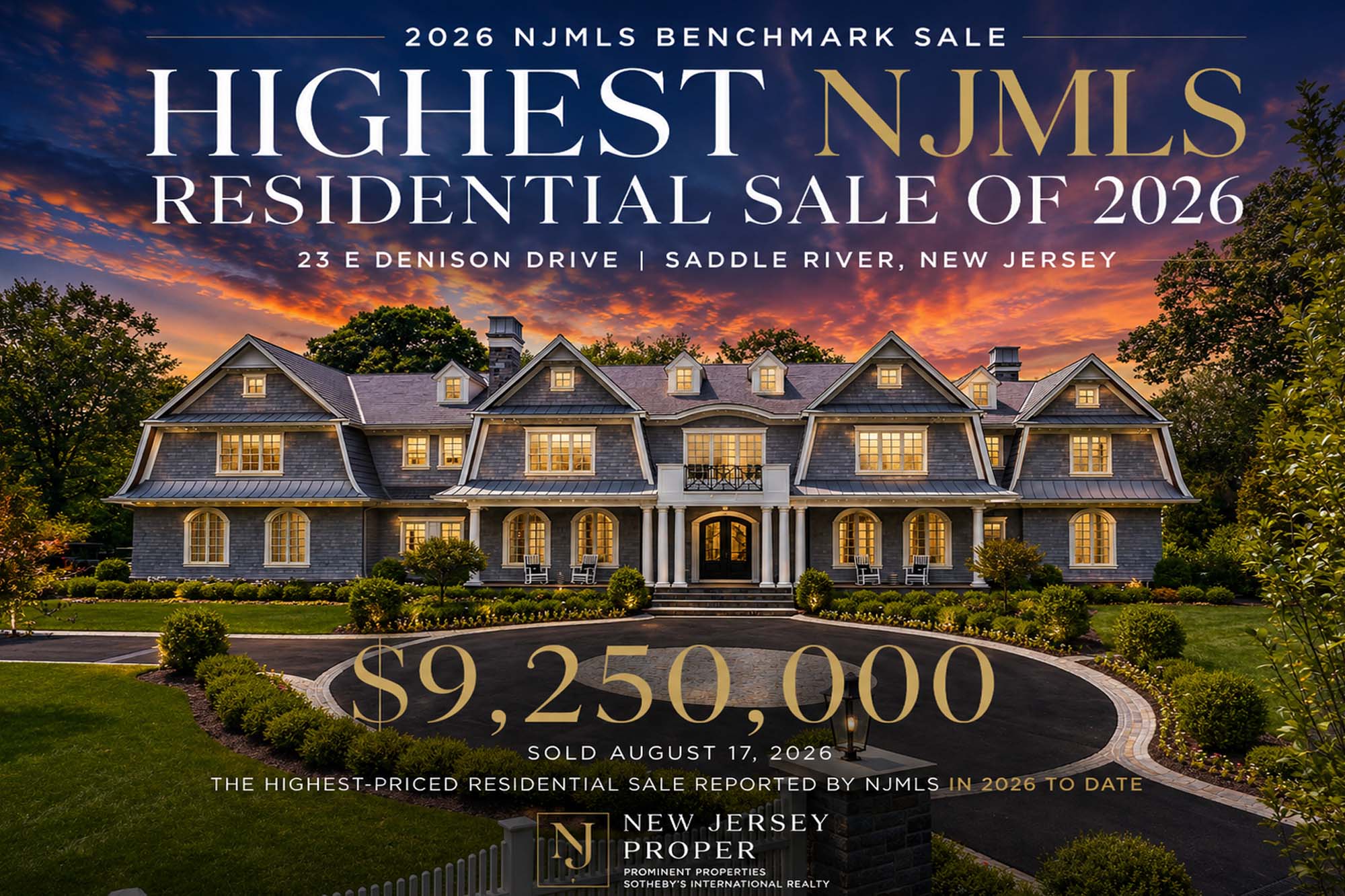
Five Highest-Priced NJMLS Residential Sale…
The $9.25 million closing of 23 E Denison Drive is the highest-priced qualifying NJMLS residential s…

The Northern New Jersey Luxury Price Ladde…
A million-dollar budget can produce very different results across Northern New Jersey. Here is how l…
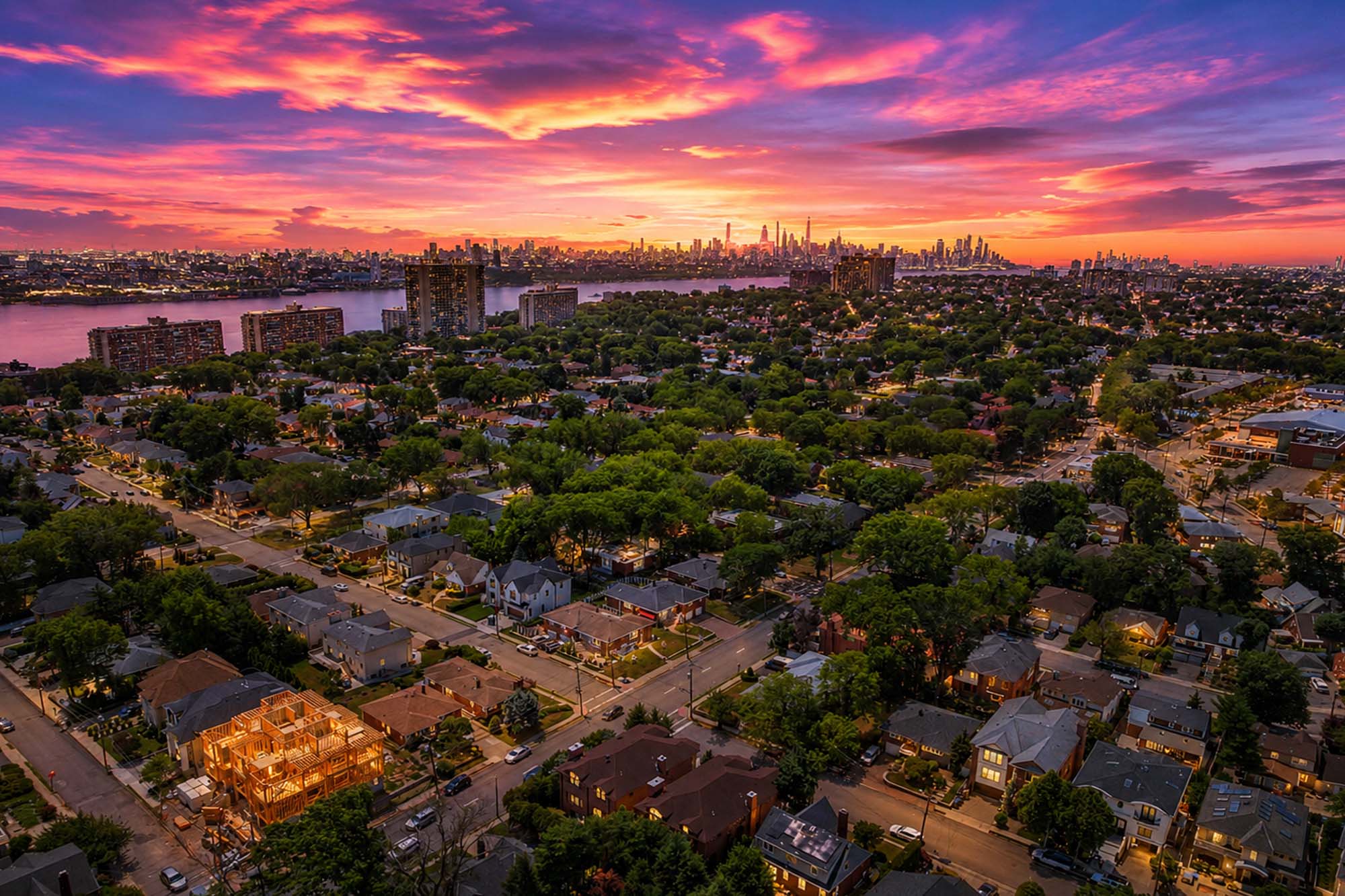
Why Bergen County Continues to Attract NYC…
Proximity to Manhattan is only part of the story. Bergen County offers space, architectural variety,…